Project Background and overview
Despite national and international nutrient emission restrictions, large quantities of nutrients continue to be washed into the sea from the Baltic basin, depleting both the ecological state of the sea and the well-being of local communities. The Waterdrive project promotes good water management and water management practices by providing different operators and active rural communities in the region with peer learning and tools for processing spatial data sets, for example. Through the diverse training materials produced in the workshops and the project, we will contribute to the proven spread of practices, both in selected pilot areas and among the partners in the project. The project will take new, and why not also good, older scientific developments to the grassroots, that is operators, who are effectively putting the measures in place. The project consists of the following work packages:
- WP1 Project Coordination and Management
- WP2 Cross-Sector Implementation
- WP3 Advancing new technologies and methods
- WP4 Adapting policies and financing
- WP5 Strategic impacts and environmental investments
The project will activate actors at the local level and develop policies and means to stimulate work at the local level. The aim is to improve the ecological state and resilience of the waters of the agricultural-intensive regions against the challenges posed by climate change throughout the Baltic basin. Pilot projects will help develop cooperation, effectiveness and inform funding opportunities among different stakeholders in areas such as agricultural water economy projects. In addition, the best verified environmental measures are raised and promoted to their disintegration. The project will create a digital education package in support of the various agricultural communities in the region. Digital tools are developed for optimal placement of measures and managing drought and flood risks and interacting with operators in the region to brainstorm the need for new thematic maps. At the end of the project, procedural recommendations for drainage and water management in agricultural areas of the Baltic Sea region countries will be drawn up.

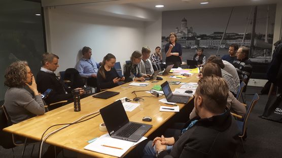
Developing water management in agriculture and forestry at a national workshop. © Picture: Sari Väisänen
The Waterdrive Consortium consists of 18 partner organisations from EU countries. It brings together national, regional and local authorities, research institutes, agricultural advisory organisations, lobbying organisations, environmental organisations and businesses. Finnish partners and stakeholders are widely involved in the whole project, focusing in particular on the implementation of catchment specific entities in pilot areas in cooperation with national projects.
SYKE's role in project
SYKE is mostly involved in work package 3. A number of projects are currently underway in Finland, where the entire river basin is under review. In the Waterdrive project, combining spatial data and observational data will produce thematic maps that provide a better overall picture of land use in the area, soil, slope of fields and also other hotspots such as forest ditching. Catchment areas can be delineated using digital elevation models. High-resolution digital elevation data also allows, for example, to map flood-sensitive areas, calculate the slope of the land and estimate erosion. Thematic maps help target exclusion zones, wetlands and other water conservation measures to places where they achieve the best benefits. In the project, SYKE compiles thematic maps for use by operators in the region and promotes the wider use of spatial datasets in agricultural advice. The work package assembles solutions to various problems in water management and water management. Confidence, transparency and long-term interaction between players in the region will be key to finding the best solutions.

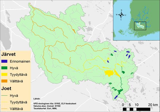
Ecological status of water bodies in river Loimijoki basin. © SYKE
Finnish partners are also involved in the production of training material. In the project, the Swedish partner (SLU) will also produce a spatial data-based cellphone app for use by farmers to target measures at optimal locations.
Waterdrive will continue until the end of 2021 and is coordinated by the Swedish Agricultural University SLU. The website of the project can be found here:
https://water-drive.eu/
Current
On January 26, 2021, the workshop “Workshop II for Water Management and Management in Agriculture and Forestry was held.
Workshop program and presentations (in finnish)
and outputs of group work