The extensive datasets produced by Finnish Environment Institute (Syke) are mostly open access. Much of the monitoring data is available online in real time. In addition to its own data, Syke regularly delivers data into several international databases.

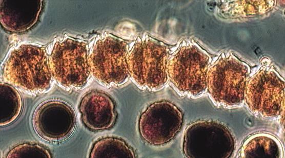
In the Baltic phytoplankton community, the proportion of dinoflagellates (in the microscope picture) has increased, and the proportion of diatoms has decreased. Photo: Seija Hällfors
Marine data of Syke
Meriaineistot.fi/en
Search marine spatial and research data produced by all the Finnish institutes that produce marine data and download data for personal use. You can also view the data on a map.
Merihavainnot.fi
Search and download data and time series of water quality, marine weather and the physical properties of the sea easily in table format.
VELMU Map Service
The Map Service allows you to view and print point data and map layers describing species, biotypes and environmental variables collected in the VELMU Programme (The Finnish Inventory Programme for Underwater Marine Diversity).
Algaline results
Algaline (or Alg@line) is a monitoring project in which data on the state of the Baltic Sea is collected using continuously running measuring instruments on board passenger and merchant ships.
Open information service of Syke
The service includes information saved in the data systems of Finland’s environmental administration about water resources, the state of surface waters, ground waters, species, environmental load and land use, and spatial datasets related to the environment.
Syke’s Metadata Portal
Syke’s Metadata Portal is meant for searching for the spatial datasets and remote sensing data of the Finnish environmental administration and the metadata descriptions of information systems. The service also contains metadata of the spatial data directory of the National Land Survey of Finland.
Marine data of Syke in other services
Map and Data Service
(HELCOM)
A map service where you can view and download GIS data.
Baltic Sea Monitoring data
(ICES)
EMODnet Chemistry portal
Marine and coastal area monitoring data produced by SYKE.